Flooding in Coromandel Peninsular
Coromandel Flooding 2026: How the Peninsula Was Hit and What It Means for Roads & Communities
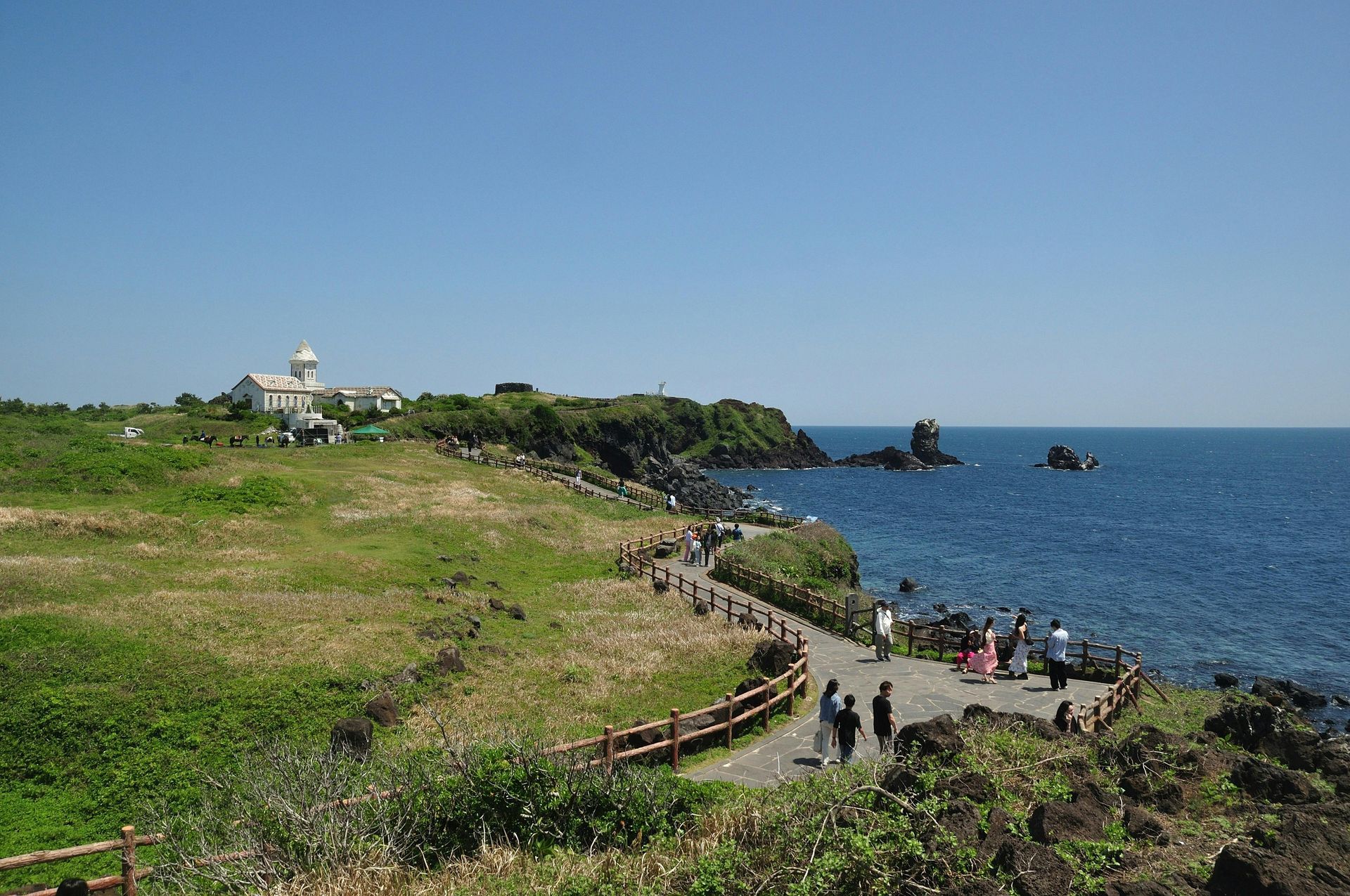
The Coromandel Peninsula — a scenic jewel on the eastern side of Aotearoa’s North Island — is known for its rugged coastlines, lush forests, and iconic white-sand beaches. But in late January 2026, a powerful weather system brought days of relentless rain, flooding, and slips that overwhelmed the region’s infrastructure and cut off many communities from road access. The flooding became one of the most disruptive weather events the area has seen in years.
🌧️ The Weather: A Subtropical Low Unleashed
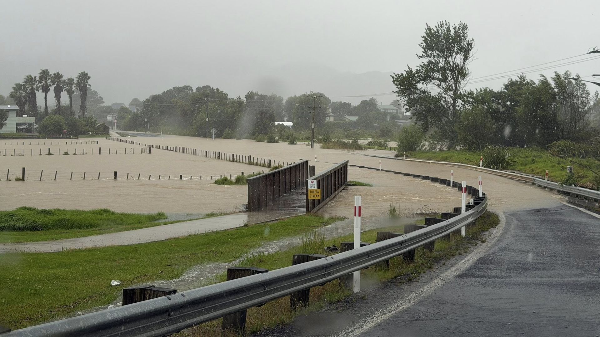
From around 20–22 January 2026, a subtropical low-pressure system — drawing moisture from warm tropical waters — descended over the North Island, bringing record rainfall, saturated soils, swollen rivers, and widespread flooding. Coromandel, Northland, Bay of Plenty, and surrounding areas were put under red heavy rain warnings, the highest level issued by MetService, meaning danger to life from flooding and slips.
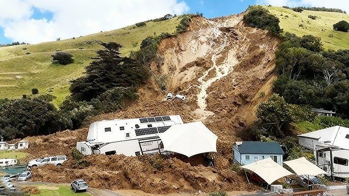
Thames-Coromandel District was placed under a state of local emergency as rain inundated roads and properties, prompting evacuations and urgent civil defence action.
🛣️ Road Closures and Transportation Chaos
The severity of the flooding hit Coromandel’s transportation network hard. Heavy rain, surface flooding, slips, and fallen trees made many state highways impassable. The NZ Transport Agency (Waka Kotahi) issued rolling updates as crews battled to keep key routes open and safe.
🚧 Major Roads Closed
These road closures had significant impact on travel around the peninsula:
🔒 Completely Closed Sections
- SH2 between Paeroa and Waihi — closed in both directions due to flooding.
- SH25 (Coromandel Town ↔ Whitianga) — closed at multiple points south and north of Whitianga after flood waters covered the highway.
- SH25 Whangamata ↔ Whiritoa — blocked after large slips and surface flooding.
- SH25 Hikuai ↔ Whangamata — blocked due to a major slip near Opoutere Rd.
These closures effectively cut access to Whitianga and other coastal communities along SH25, which circles the Coromandel Peninsula, leaving residents and tourists unable to enter or leave via the main highway.
🚗 Partial Access with Restrictions
Several road sections were reopened but only with caution:
- SH25 Hikuai to Tairua — open with speed restrictions and a single lane at Hikuai Bridge.
- SH25 Whitianga to Tairua — open with restrictions.
- SH25 Whiritoa to Waihi — reopened.
- SH25A Kopu to Hikuai — reopened after earlier closure.
- SH26 Te Aroha Bridge to Paeroa — reopened after flood-induced closure.
Despite these reopenings, many smaller local roads remained restricted or closed due to slips, surface water, and ongoing safety assessments.
🏘️ Community Impact
The flooding didn’t just block highways — it isolated entire communities, disrupted essential services, and caused property damage. Residents in areas like Tairua, Pauanui, Whangamata, and Coromandel Town faced limited access to food, supplies, and emergency services.
Local authorities urged people to avoid all non-essential travel, keep updated on road conditions, and never drive through floodwaters (even shallow water can sweep vehicles away).
Schools, refuse services, and local collections were affected, with cancellations announced for areas including Matarangi, Coromandel Rural North, Opito, and Otama due to access issues.
🚧 What Comes Next for Coromandel Roads?
Repairing and reopening roads in Coromandel is a major task:
- Priority work was focused on reopening the link from Whangamata to Hikuai and the Karangahake Gorge route (SH2) between Paeroa and Waihi.
- Helicopters were used for aerial assessments where ground access was unsafe.
- Slips and debris removal continues, with crews working long hours in challenging conditions.
Local councils and emergency services also emphasised longer-term planning to improve the resilience of Coromandel’s roading network to future extreme weather events.
🌤️ A Slow Recovery Ahead
As of 23 January, the rain had eased and floodwaters were receding, but the impacts of the storm remain evident across the Coromandel Peninsula. Roads are gradually reopening, but motorists are urged to stay informed, drive carefully, and be patient with ongoing closures and restrictions.
The flooding has tested communities, but the priority now is restoring safe access, supporting those affected, and building a more resilient future for this beloved part of Aotearoa.